HOME


ALL JOURNALS


                                WAITOMO REGION                                 

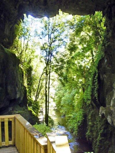
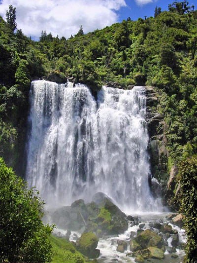
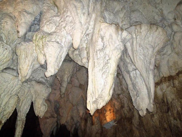
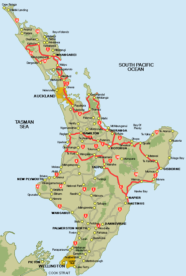
TOURING THE NORTH ISLAND (con't)

From the coast road we turned inland at Marokopa to visit the Waitomo region, one of the world's greenest places. Volcanic activity has enriched the soil producing lush grass for raising dairy cattle and sheep.

Green rolling hills, lush with pasture and orchards, hide a subterranean world of incredible cave networks.  The name Waitomo comes from wai (water) and tomo (hole or shaft). Throughout the country are numerous shafts dropping abruptly into underground cave systems and streams. There are more than 300 mapped caves in the area forming the magical landscape that was once part of a seabed..

DRIVING ROUTE-click to enlarge (then HOLD mouse on pic until icon appears & click icon again to expand)

A World Above and Below!

Beneath the dramatic limestone formations hundreds of kilometers of caves form a beautiful world that we wanted to discover for ourselves.

Piripiri Caves

We reached these caves from a 30 minute walking track on a muddy trail. The caves are reported to have the fossilized remains of shellfish embedded in their walls, a reminder that the landscape was beneath the sea.

The entrance to the cave was steep and foreboding. You needed to be a serious caver with the proper equipment to venture inside this one. Gord was trying to coax us into the cave but we resisted the challenge to venture further.

Mangapohue Natural Bridge Scenic Reserve

One of our favorite place was the Mangapohue Natural Bridge, reached by a boardwalk leading through a forest-clad gorge. The  impressive natural rock arch has been carved out of soft limestone by the Mangapohue River.


The walkway follows the river and winds under rock faces covered with foliage


From the Bridge, the trail continued through a farm with limestone outcrops jutting up out of the grass, the big rocks full of oyster fossils.


Manokopa Falls

The Manokopa Falls are truly beautiful falls, located right on the edge of the contact zone between limestone and volcanic rock formations. The falls drop 37m over a faultline into the deep valley of the Manokopa River.

Aranui Caves

The Aranui Cave is part of the Waitomo Cave System, which is a 50 km labyrinth of limestone caves.

Entrance to
Aranui Cave

The Caves were formed over thousands of years as water carrying acids from decomposing plant matter dissolved its way through the limestone rock.

The dripping water has added to the magic, creating eerie limestone sculptures in the stalagmites and stalactites that pepper the caves.

Goofing Off

Chris & Gord
Healed over in
the Parking Lot.

Click here for PHOTOS OF WAITOMO AREA

next.....

HAWKES BAY & AUCKLAND >>>>

HOME

NEW ZEALAND INDEX

ALL JOURNALS